Category:Fairburn, North Yorkshire
Jump to navigation
Jump to search
village and civil parish in North Yorkshire, UK  | |||||
| Upload media | |||||
| Instance of | |||||
|---|---|---|---|---|---|
| Location | Selby, North Yorkshire, Yorkshire and the Humber, England | ||||
| Said to be the same as | Fairburn (Wikimedia duplicated page, civil parish) | ||||
 | |||||
English: Fairburn is a small village and civil parish in the Selby district of North Yorkshire, England. Situated approximately 10 miles (16 km) to the east of Leeds, lying close to the A1(M) motorway and 4 miles (6 km) from the M62 motorway.
Subcategories
This category has the following 6 subcategories, out of 6 total.
F
- Fairburn Ings (103 F)
Media in category "Fairburn, North Yorkshire"
The following 200 files are in this category, out of 313 total.
(previous page) (next page)-
 "Charlie Winn" Hide Fairburn Ings - geograph.org.uk - 2895445.jpg 3,145 × 2,366; 2 MB
-

-
 A 'Forest' of Pylons - geograph.org.uk - 3110366.jpg 1,530 × 990; 167 KB
-
 A cold day at Fairburn Ings - geograph.org.uk - 2729207.jpg 1,600 × 1,200; 214 KB
-
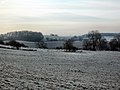 A frosty walk from Fairburn to Ledsham - geograph.org.uk - 3257149.jpg 4,288 × 3,216; 2.65 MB
-
 A Harrowing experience - geograph.org.uk - 2857572.jpg 2,806 × 3,121; 2.29 MB
-
 A misty Fairburn cut lane - geograph.org.uk - 5734195.jpg 2,443 × 3,723; 1.86 MB
-
 A misty morning at Fairburn ings - geograph.org.uk - 5651859.jpg 3,456 × 4,608; 3.58 MB
-
 A pair of Black Swans on Fairburn Ings - geograph.org.uk - 2373965.jpg 1,219 × 1,600; 309 KB
-
 A walk from Fairburn to Ledsham - geograph.org.uk - 2753888.jpg 3,491 × 2,299; 1.74 MB
-
 A walk from Glass Houghton ^33 - geograph.org.uk - 1996816.jpg 800 × 600; 201 KB
-
 A walk from Glass Houghton ^34 - geograph.org.uk - 1996820.jpg 800 × 600; 281 KB
-
 A walk from Glass Houghton ^35 - geograph.org.uk - 1996827.jpg 800 × 600; 261 KB
-
 A walk from Glass Houghton ^36 - geograph.org.uk - 1996832.jpg 800 × 600; 329 KB
-
 A walk from Glass Houghton ^38 - geograph.org.uk - 1996843.jpg 800 × 600; 348 KB
-
 A walk from Glass Houghton ^39 - geograph.org.uk - 1996848.jpg 800 × 600; 211 KB
-
 A walk from Glass Houghton ^40 - geograph.org.uk - 1996854.jpg 800 × 600; 262 KB
-
 A walk from Glass Houghton ^41 - geograph.org.uk - 1996857.jpg 800 × 600; 245 KB
-
 A walk from Glass Houghton ^42 - geograph.org.uk - 1996862.jpg 800 × 600; 213 KB
-
 A walk from Glass Houghton ^43 - geograph.org.uk - 1996868.jpg 800 × 600; 215 KB
-
 A walk from Glass Houghton ^44 - geograph.org.uk - 1996874.jpg 800 × 600; 225 KB
-
 A walk from Glass Houghton ^45 - geograph.org.uk - 1996877.jpg 800 × 600; 303 KB
-
 A walk from Glass Houghton ^46 - geograph.org.uk - 1996883.jpg 800 × 600; 349 KB
-
 A walk from Glass Houghton ^47 - geograph.org.uk - 1996888.jpg 800 × 600; 392 KB
-
 A walk from Glass Houghton ^48 - geograph.org.uk - 1996892.jpg 800 × 600; 232 KB
-
 A walk from Glass Houghton ^49 - geograph.org.uk - 1996897.jpg 800 × 600; 228 KB
-
 A walk from Glass Houghton ^50 - geograph.org.uk - 1996904.jpg 800 × 600; 227 KB
-
 A walk in the woods - geograph.org.uk - 6007971.jpg 1,280 × 855; 439 KB
-
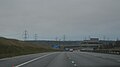
 A1(M) - junction 42 in 1-2 mile - geograph.org.uk - 4382481.jpg 640 × 428; 72 KB
-
 A1(M) - Rawfield Lane bridge - geograph.org.uk - 2646536.jpg 640 × 428; 74 KB
-
 A1(M) junction 42 - geograph.org.uk - 2646540.jpg 640 × 428; 65 KB
-
 A1(M) near Fairburn - geograph.org.uk - 2040760.jpg 640 × 480; 61 KB
-
 A1(M) near Fairburn - geograph.org.uk - 2040765.jpg 640 × 480; 59 KB
-
 A1(M) near Fairburn - geograph.org.uk - 4382502.jpg 640 × 428; 73 KB
-
 A1(M) northbound - geograph.org.uk - 3035210.jpg 640 × 430; 39 KB
-
 A1(M) river bridge - geograph.org.uk - 5652127.jpg 4,608 × 3,456; 3.85 MB
-
 A1(M), southbound - geograph.org.uk - 4806180.jpg 640 × 360; 20 KB
-
 A1(M), southbound - geograph.org.uk - 4806181.jpg 640 × 364; 24 KB
-
 Abandoned car on Beckfield Lane, Fairburn - geograph.org.uk - 4444939.jpg 1,600 × 1,062; 778 KB
-

-
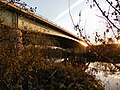
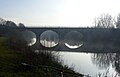 Aire Bridge, Fairburn - geograph.org.uk - 6010377.jpg 1,280 × 822; 136 KB
-
 Aire valley west of Fairburn - geograph.org.uk - 540762.jpg 640 × 480; 96 KB
-
 Approaching Palmerston Lodge, Fairburn - geograph.org.uk - 3481455.jpg 2,048 × 1,536; 551 KB
-
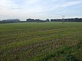
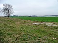
 Arable and pastoral - geograph.org.uk - 885273.jpg 640 × 435; 236 KB
-
 Autumn at Fairburn Ings RSPB nature reserve - geograph.org.uk - 2709839.jpg 1,600 × 1,101; 234 KB
-
 Bank above the Aire - geograph.org.uk - 3831790.jpg 1,920 × 1,440; 665 KB
-
 Barn on Silver Street, Fairburn - geograph.org.uk - 4445271.jpg 1,600 × 1,062; 716 KB
-
 Beckfield Farm Fairburn - geograph.org.uk - 2762324.jpg 2,779 × 1,866; 919 KB
-
 Beckfield Farm Fairburn - geograph.org.uk - 3257180.jpg 4,288 × 3,216; 4.56 MB
-
 Beckfield Farm, Fairburn - geograph.org.uk - 2753910.jpg 2,889 × 1,981; 1.2 MB
-
 Beckfield Lane towards Fairburn - geograph.org.uk - 4444937.jpg 1,600 × 1,062; 875 KB
-
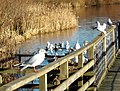
 Birds at the end of the boardwalk - geograph.org.uk - 2737182.jpg 1,024 × 768; 155 KB
-
 Bridge over A1(M) near Fairburn - geograph.org.uk - 5893476.jpg 1,024 × 652; 94 KB
-
 Bridleway crossing south of Selby Fork - geograph.org.uk - 3724999.jpg 1,600 × 1,200; 509 KB
-
 Bumps for BMX fans - geograph.org.uk - 1620328.jpg 640 × 480; 89 KB
-
 Caudle Hill, Fairburn - geograph.org.uk - 6010362.jpg 1,280 × 841; 164 KB
-
 Caution Work in Progress - geograph.org.uk - 2783490.jpg 1,760 × 1,168; 368 KB
-
 Chapel Yard off Gauk Street, Fairburn - geograph.org.uk - 4445262.jpg 1,600 × 1,062; 564 KB
-
-
 Coal Train Passing Fairburn Ings - geograph.org.uk - 3305822.jpg 3,664 × 2,651; 2.89 MB
-

-
 County boundary - geograph.org.uk - 2745485.jpg 1,280 × 959; 364 KB
-
 Cross Hill, Fairburn - geograph.org.uk - 6010361.jpg 1,280 × 960; 229 KB
-
 Cut Lane bridge Fairburn Ings - geograph.org.uk - 5649766.jpg 4,608 × 3,072; 3.74 MB
-
 Cut Lane Fairburn - geograph.org.uk - 3305814.jpg 3,216 × 4,288; 5.46 MB
-
 Cut Lane Fairburn - geograph.org.uk - 5654666.jpg 3,456 × 4,608; 4.33 MB
-
 Cut Road - geograph.org.uk - 783423.jpg 480 × 640; 62 KB
-
 Ducking and Diving for a bit of open water - geograph.org.uk - 3257145.jpg 4,288 × 3,216; 6.38 MB
-
 Electricity pylon dwarfs Fryston Hall Farm - geograph.org.uk - 2402943.jpg 1,600 × 1,169; 393 KB
-
 Electricity Pylons - geograph.org.uk - 266674.jpg 640 × 480; 64 KB
-
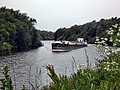
 Empty Barge being pushed Downstream. (Part 1) - geograph.org.uk - 2945179.jpg 2,588 × 3,001; 1.18 MB
-
 End of the road - geograph.org.uk - 2783382.jpg 1,162 × 1,149; 306 KB
-

-
 Entrance from pavement to field - geograph.org.uk - 1620306.jpg 640 × 480; 90 KB
-
 Expecting to be fed - geograph.org.uk - 2737170.jpg 1,024 × 768; 157 KB
-
 Fairburn "white horses" - geograph.org.uk - 5656911.jpg 3,960 × 2,409; 2.02 MB
-
 Fairburn - geograph.org.uk - 434599.jpg 640 × 480; 91 KB
-
 Fairburn and Railway - geograph.org.uk - 1524859.jpg 480 × 640; 84 KB
-
 Fairburn Cut Footpath - geograph.org.uk - 2730543.jpg 1,277 × 1,600; 509 KB
-
 Fairburn Cut Lane - geograph.org.uk - 2799422.jpg 3,216 × 4,288; 2.95 MB
-
 Fairburn Gaol - geograph.org.uk - 3305868.jpg 3,631 × 2,385; 2.55 MB
-
 Fairburn Ings - geograph.org.uk - 2627655.jpg 1,600 × 1,200; 377 KB
-
 Fairburn Ings - geograph.org.uk - 2627660.jpg 1,600 × 1,200; 459 KB
-
 Fairburn Ings - geograph.org.uk - 2745499.jpg 1,280 × 854; 296 KB
-
 Fairburn Ings - geograph.org.uk - 2789606.jpg 3,249 × 2,064; 863 KB
-
 Fairburn Ings - geograph.org.uk - 3163632.jpg 2,048 × 1,536; 569 KB
-
 Fairburn Ings - geograph.org.uk - 6010366.jpg 1,280 × 855; 89 KB
-
 Fairburn Ings - geograph.org.uk - 6010396.jpg 1,280 × 855; 343 KB
-
 Fairburn Ings - Village Bay Viewpoint - geograph.org.uk - 6010364.jpg 1,280 × 855; 241 KB
-
 Fairburn Ings Footpath - geograph.org.uk - 2857560.jpg 2,674 × 3,522; 3.14 MB
-
 Fairburn Ings from the RSPB car park - geograph.org.uk - 2006251.jpg 640 × 427; 65 KB
-
 Fairburn Ings frozen under ice and snow - geograph.org.uk - 2799407.jpg 4,288 × 3,216; 2.29 MB
-
 Fairburn Ings Great Crested Grebe - geograph.org.uk - 2373959.jpg 719 × 800; 104 KB
-
 Fairburn Ings iced over - geograph.org.uk - 5651976.jpg 4,608 × 3,456; 3.51 MB
-
 Fairburn Ings main lake - geograph.org.uk - 5656879.jpg 4,608 × 3,456; 3.68 MB
-
 Fairburn Ings Main Lake - geograph.org.uk - 5973093.jpg 4,608 × 3,072; 2.85 MB
-
 Fairburn Ings main lake. - geograph.org.uk - 5654681.jpg 4,608 × 3,456; 2.61 MB
-
 Fairburn Ings Nature Reserve - geograph.org.uk - 4445392.jpg 1,600 × 1,062; 1,015 KB
-
 Fairburn Ings Nature Reserve - geograph.org.uk - 4445427.jpg 1,547 × 1,447; 549 KB
-
 Fairburn Ings Nature Reserve - geograph.org.uk - 4445437.jpg 1,600 × 1,062; 931 KB
-
 Fairburn Ings nature reserve - geograph.org.uk - 6054720.jpg 4,608 × 3,072; 2.4 MB
-
 Fairburn Ings one month on - geograph.org.uk - 3563364.jpg 4,288 × 3,216; 2.36 MB
-
 Fairburn Ings RSPB - geograph.org.uk - 5649775.jpg 4,442 × 2,802; 2.5 MB
-
 Fairburn Ings RSPB bird sanctuary - geograph.org.uk - 2609645.jpg 1,600 × 1,015; 324 KB
-
 Fairburn Ings RSPB nature reserve - geograph.org.uk - 2402905.jpg 1,600 × 949; 335 KB
-
 Fairburn Ings RSPB Nature Reserve - geograph.org.uk - 3527218.jpg 1,073 × 805; 286 KB
-
 Fairburn Ings RSPB nature reserve - geograph.org.uk - 5664769.jpg 4,608 × 3,456; 4.45 MB
-
 Fairburn Ings RSPB Nature Reserve begiuning to ice over - geograph.org.uk - 3257140.jpg 4,288 × 3,216; 2.5 MB
-
 Fairburn Ings under ice - geograph.org.uk - 3305850.jpg 4,288 × 3,216; 2.53 MB
-
 Fairburn Ings viewed from "Cut Lane" - geograph.org.uk - 2775882.jpg 4,288 × 3,216; 2.07 MB
-
 Fairburn Ings viewed from Newfield lane - geograph.org.uk - 2789645.jpg 3,868 × 2,588; 1.58 MB
-
 Fairburn Ings Village Bay Hide - geograph.org.uk - 2857562.jpg 3,196 × 2,429; 2.4 MB
-
 Fairburn Ings Visitor Centre - geograph.org.uk - 2745487.jpg 1,280 × 959; 338 KB
-
 Fairburn Ings Woodland Walk - geograph.org.uk - 3028418.jpg 3,611 × 2,404; 3.12 MB
-
 Fairburn Ings ^ the "Three Bridges" - geograph.org.uk - 2709837.jpg 1,600 × 1,005; 246 KB
-
 Fairburn Ings, Christmas Day 2018 - geograph.org.uk - 6010380.jpg 1,280 × 855; 440 KB
-
 Fairburn Junior School - geograph.org.uk - 243408.jpg 640 × 480; 93 KB
-
 Fairburn playground in the rain - geograph.org.uk - 4080019.jpg 1,024 × 768; 133 KB
-
 Fairburn Railway Line and Ings - geograph.org.uk - 2799413.jpg 2,979 × 3,459; 2.18 MB
-
 Fairburn tornado^ - geograph.org.uk - 5698033.jpg 2,048 × 1,536; 302 KB
-
 Fairburn View Apartments viewed from Charlie Whinn Hide - geograph.org.uk - 3305844.jpg 4,288 × 3,216; 3.13 MB
-
 Fairburn village - geograph.org.uk - 2745504.jpg 1,280 × 946; 369 KB
-
 Fairburn village ahead - geograph.org.uk - 2006236.jpg 640 × 427; 73 KB
-
 Fairburn Village viewed from Fryston Woods - geograph.org.uk - 3305811.jpg 3,144 × 1,971; 1.23 MB
-
 Fairburn War Memorial - geograph.org.uk - 2402893.jpg 1,179 × 1,600; 530 KB
-
 Farm Buildings near Caudle hill Plantation Fairburn - geograph.org.uk - 2775725.jpg 3,921 × 2,683; 1.55 MB
-
 Farm land below Lambkip Hill - geograph.org.uk - 4444924.jpg 1,600 × 1,062; 659 KB
-
 Farmland near Beckfield Lane, Fairburn - geograph.org.uk - 4444935.jpg 1,600 × 1,062; 747 KB
-
 Farmland off Lunnfields lane - geograph.org.uk - 2627628.jpg 1,600 × 1,200; 479 KB
-
 Feeding the Birds at Fairburn. - geograph.org.uk - 2762320.jpg 2,665 × 2,028; 1.27 MB
-
 Feeding the ducks - geograph.org.uk - 3257220.jpg 3,216 × 4,288; 2.51 MB
-
 Fly-tipping on Lambkin Hill - geograph.org.uk - 2850078.jpg 1,024 × 768; 152 KB
-
 Footpath along 'The Cut' - geograph.org.uk - 434526.jpg 640 × 480; 173 KB
-
 Footpath below Fairburn - geograph.org.uk - 2745509.jpg 1,280 × 905; 291 KB
-
 Footpath in Womstall Wood - geograph.org.uk - 4444904.jpg 1,600 × 1,062; 1.03 MB
-
 Footpath leading to Fairburn Ings - geograph.org.uk - 4445313.jpg 1,600 × 1,062; 642 KB
-
 Frosty Fairburn Bridge - geograph.org.uk - 5655620.jpg 4,608 × 3,456; 3.04 MB
-
 Frosty Ferrybridge Power Station - geograph.org.uk - 3257135.jpg 4,288 × 3,216; 1.89 MB
-
 Fryston Hall Farm - geograph.org.uk - 2799401.jpg 2,447 × 1,657; 642 KB
-
 Glistening waters - geograph.org.uk - 5654662.jpg 4,608 × 3,456; 1.89 MB
-
 Great North Road, Fairburn - geograph.org.uk - 5790739.jpg 1,024 × 768; 220 KB
-
 Gulls on Fairburn Ings - geograph.org.uk - 2762331.jpg 3,216 × 4,288; 2.4 MB
-
 Half submerged willow bush in Fairburn ings - geograph.org.uk - 5734191.jpg 4,288 × 3,216; 2.19 MB
-
 Hall Farm viewed from Fryston woods - geograph.org.uk - 3239477.jpg 3,228 × 2,391; 1.56 MB
-
 Harvest Time - geograph.org.uk - 241411.jpg 640 × 414; 34 KB
-
 Heading Downstream - geograph.org.uk - 3563366.jpg 4,288 × 3,216; 3.4 MB
-
 Houses on Manor Court, Fairburn - geograph.org.uk - 4444970.jpg 1,600 × 1,062; 690 KB
-
 Houses on Top House Farm News - geograph.org.uk - 4444526.jpg 1,600 × 1,062; 965 KB
-
 Houses overlooking Fairburn Ings - geograph.org.uk - 4445385.jpg 1,600 × 1,062; 1.08 MB
-
 Humber Barge heading home - geograph.org.uk - 3138056.jpg 4,288 × 3,216; 4.77 MB
-
 Ice breaking at Fairburn Ings - geograph.org.uk - 3338486.jpg 4,288 × 3,216; 2.69 MB
-
 Iced lake at Fairburn Ings - geograph.org.uk - 2789580.jpg 4,146 × 3,026; 1.71 MB
-
 Iced over lake - geograph.org.uk - 3338497.jpg 3,588 × 2,377; 2.15 MB
-
 It's a two horse race - geograph.org.uk - 2857597.jpg 3,862 × 2,842; 1.68 MB
-
 Jew's Ear (Auricularia auricula-judae) - geograph.org.uk - 6010371.jpg 1,280 × 855; 158 KB
-
 Junction 42 bridge, A1(M) - geograph.org.uk - 3035222.jpg 640 × 430; 36 KB
-
 Junction 42, A1(M) - geograph.org.uk - 3035216.jpg 640 × 375; 32 KB
-

-

-

-

-

-
 Lake at Fairburn Ings Reserve - geograph.org.uk - 2695306.jpg 1,024 × 683; 240 KB
-
 Lamb number 6 - geograph.org.uk - 2857606.jpg 1,940 × 2,724; 1.51 MB
-
 Lambkin Hill farmland, above Ledsham Beck - geograph.org.uk - 2850084.jpg 1,024 × 768; 150 KB
-
 Lambs and lambkin plantation Ledsham - geograph.org.uk - 5664649.jpg 4,608 × 3,456; 4.66 MB
-
 Landscape near Fairburn - geograph.org.uk - 2745525.jpg 1,280 × 959; 303 KB
-
 Lazy Daze on the river - geograph.org.uk - 5666182.jpg 4,608 × 3,456; 4.78 MB
-
 Like ducks to water. - geograph.org.uk - 2799405.jpg 2,456 × 1,767; 838 KB
-
 Looking towards Fairburn Ings, Fairburn - geograph.org.uk - 4445317.jpg 1,600 × 1,062; 595 KB
-
 Low Holland - geograph.org.uk - 2745507.jpg 1,280 × 950; 321 KB
-
 Low Holland Fairburn - geograph.org.uk - 2775890.jpg 2,029 × 1,198; 409 KB
-
 Low sun .tall shadows - geograph.org.uk - 5651870.jpg 3,456 × 4,608; 4.94 MB
-
 Low sun reflection - geograph.org.uk - 5654674.jpg 3,456 × 4,608; 3.93 MB
-
 Low water level at Fairburn Ings - geograph.org.uk - 3640353.jpg 3,024 × 2,268; 1.26 MB
-
 Lukewell Farm off Silver Street, Fairburn - geograph.org.uk - 4445312.jpg 1,600 × 1,062; 690 KB
-

-
 Lunnfields Lane Bridge, A1(M) - geograph.org.uk - 3035196.jpg 640 × 430; 39 KB
-
 Lunnfields Lane towards Fairburn - geograph.org.uk - 2627630.jpg 1,600 × 1,200; 446 KB
-
 M1 crossing river Aire at Fairburn - geograph.org.uk - 5734186.jpg 4,288 × 3,216; 2.51 MB
-
 Messing about on the river - geograph.org.uk - 2609516.jpg 1,600 × 1,040; 246 KB
-

-
 Narrowboat "Dek'ome" - geograph.org.uk - 2890354.jpg 2,860 × 1,981; 1.38 MB
-
 Nesting Coot at the RSPB nature reserve at Fairburn Ings - geograph.org.uk - 2945219.jpg 4,080 × 3,007; 1.97 MB
-
 New crop, off Rawfield Lane - geograph.org.uk - 1620358.jpg 640 × 480; 103 KB
-
 New Holland Fairburn Ings - geograph.org.uk - 3338509.jpg 4,288 × 3,216; 3.75 MB
-
 New housing at Cut Lane - geograph.org.uk - 5664730.jpg 3,826 × 2,630; 1.81 MB
-
 New laid hedge - geograph.org.uk - 2745523.jpg 1,280 × 959; 510 KB
-
 New Motorway Bridge 2005 - geograph.org.uk - 2783482.jpg 1,760 × 1,168; 300 KB
-
 New roundabout on the former A1 - geograph.org.uk - 1620316.jpg 640 × 480; 54 KB
-
 New War Memorial at Fairburn - geograph.org.uk - 3640341.jpg 480 × 640; 113 KB
-
 Newfield lane. - geograph.org.uk - 4079116.jpg 640 × 480; 57 KB
-

-
 Newton Lane - geograph.org.uk - 2627662.jpg 1,600 × 1,200; 601 KB
-
 Newton Lane - geograph.org.uk - 2745511.jpg 1,280 × 959; 372 KB
-
 Newton Lane - geograph.org.uk - 2745514.jpg 1,280 × 959; 269 KB
-
 Newton Lane heading west - geograph.org.uk - 2627654.jpg 1,600 × 1,200; 475 KB
-
 Newton Lane, Fairburn - geograph.org.uk - 6010386.jpg 1,280 × 855; 177 KB
-
 Old Quarry at Fairburn - geograph.org.uk - 2762314.jpg 3,803 × 2,719; 1.65 MB
-
 Open fields, off Rawfield Lane - geograph.org.uk - 1620343.jpg 640 × 480; 56 KB


_-_junction_42_in_1-2_mile_-_geograph.org.uk_-_4382481.jpg)
_-_Rawfield_Lane_bridge_-_geograph.org.uk_-_2646536.jpg)
_junction_42_-_geograph.org.uk_-_2646540.jpg)
_near_Fairburn_-_geograph.org.uk_-_2040760.jpg)
_near_Fairburn_-_geograph.org.uk_-_2040765.jpg)
_near_Fairburn_-_geograph.org.uk_-_4382502.jpg)
_northbound_-_geograph.org.uk_-_3035210.jpg)
_river_bridge_-_geograph.org.uk_-_5652127.jpg)
,_southbound_-_geograph.org.uk_-_4806180.jpg)
,_southbound_-_geograph.org.uk_-_4806181.jpg)


_near_Fairburn_-_geograph.org.uk_-_5893476.jpg)


_-_geograph.org.uk_-_6010371.jpg)
_-_geograph.org.uk_-_3035222.jpg)
_-_geograph.org.uk_-_3035216.jpg)


_-_geograph.org.uk_-_2515450.jpg)
_-_geograph.org.uk_-_3035196.jpg)


_-_geograph.org.uk_-_2945179.jpg)